
graphic slider element
Technical Equipment
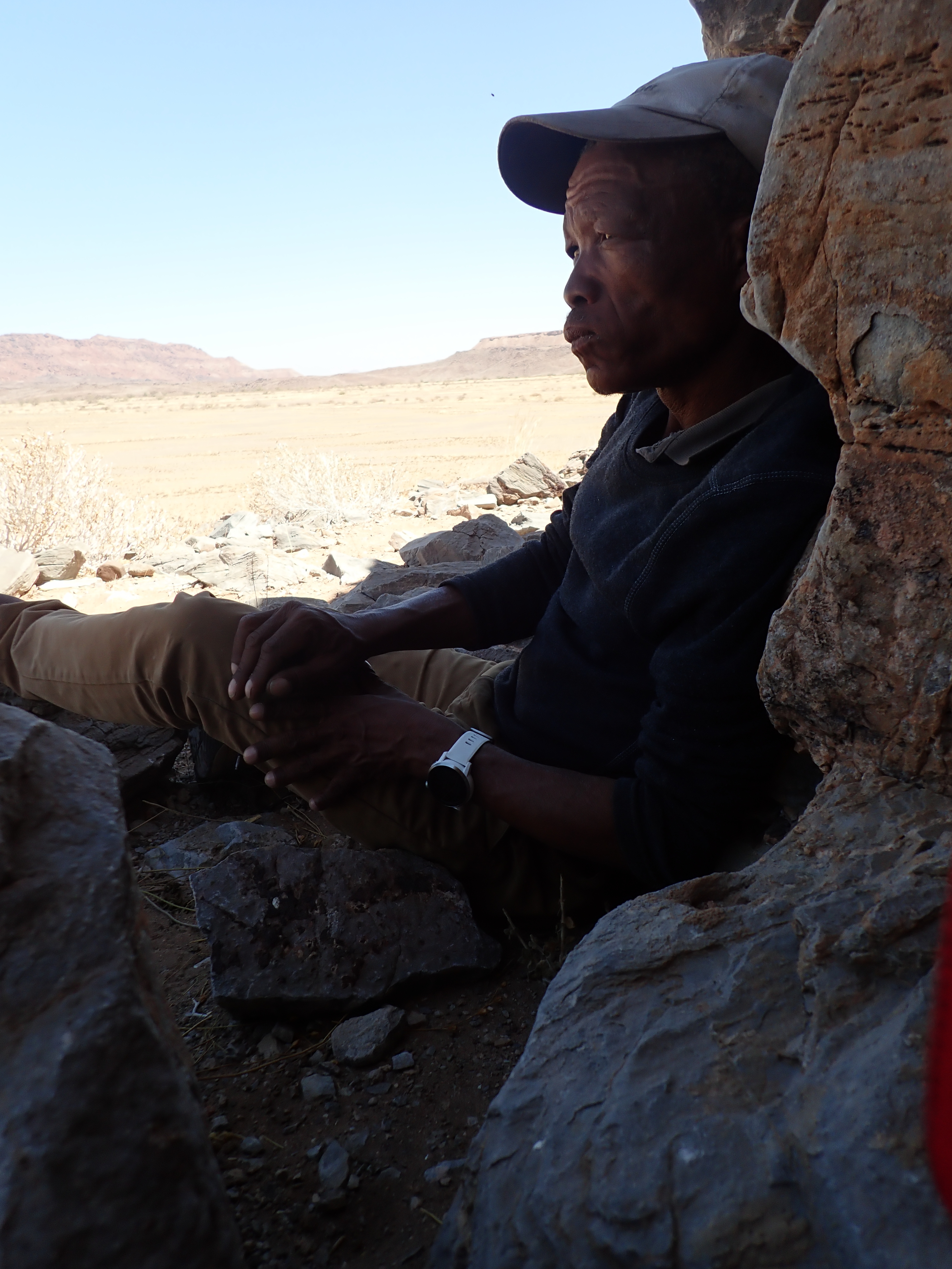
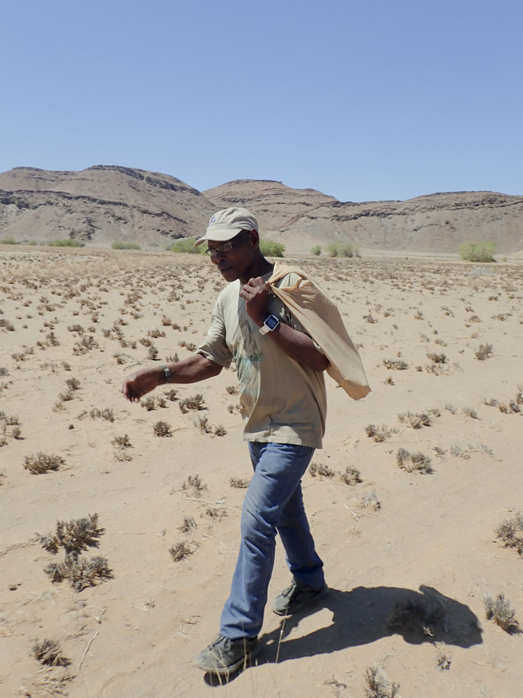
Smartwatches

The analytical objective of the project aims at improving ways of modelling hunters’ mobility. One of the modelling techniques that will be addressed – least-cost path analysis (LCP) – generally relies on measurements of human walking speed and energy expenditure on different slopes and types of terrain[1]. Different from LCP, agent-based modelling requires knowledge of decisions made during hunting that can be used for modelling. Today, walking speed can be recorded rather easily with the use of GPS devices. Improving modelling techniques related to walking speed or energy expenditure requires topography and terrain to be considered. In recent years, measuring energy expenditure became more easily accessible through sports equipment such as smartwatches dedicated to extreme sports[2][3]. These bring together GPS recording and heartrate sensor (wrist- or heartbelt sensor) with high measuring accuracy (GPS location and heartrate measurements per one or two seconds). Furthermore, such smartwatches include a barometric device which has a higher resolution and accuracy than altitude values measured via GPS. Four different kinds of smartwatches were used during field work for measuring location-based data such as walking speed and energy consumption:
2x Apex (Coros)
1x Forerunner 935 (Garmin)
These two kinds of extreme sports watches were chosen as they are able to measure GPS, heartrate and barometric altimetry over a period of 25 hours without recharging. Two different models were used to spread potential error susceptibilities. Due to budget restrictions not each participant could be equipped with project-owned extreme sports smartwatches. Therefore, personal watches were used as well:
2x Vívoactive (Garmin)
1x Forerunner 645 (Garmin)
The latter smartwatches, however, are usual sports watches lacking a barometric device. Furthermore, GPS battery time lasts for six to eight hours only. Recharging during “workouts” therefore was indispensable. Technically, heart rate can be measured by smartwatches in two ways: directly at the wrist via photoplethysmography, or externally via a chest strap. Photoplethysmography is an optical technique that detects volumetric changes in blood in peripheral circulation[4] using low-intensity infrared. Photoplethysmography has been reported to fail in case of darker skin tone and during walking[5]. External chest straps do not have these limitations because they use electrocardiogram (ECG) technology[6][7]. Since photoplethysmographic errors were to be expected due to skin tone as well as walking, each participant had to be equipped with an additional ECG chest strap (2x Garmin, 3x BerryKing). The connection between ECG belt and Smartwatch was established via ANT+, a unidirectional low-power radio technology.
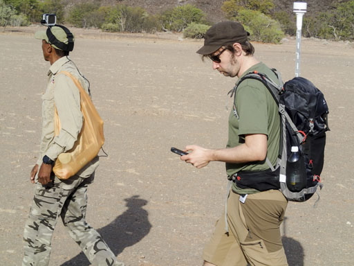
GoPro camera, Smartphones, CyberTracker


In contrast to the physical condition of the participants, aspects influencing mobility such as land cover and tracking decisions cannot be directly recorded. To a certain extent, walking speed, energy expenditure and path finding can depend on land cover, topography or wind direction. Landscape features such as water bodies, vegetation or rocky or sandy areas can be captured from a distance, e.g. by satellite imagery[8]. But in hyperarid regions like the Doro !nawas Mountains there is hardly any vegetation or water bodies. Here the documentation of land cover is limited to different degrees of solidity, or sinkage (hard - medium - soft), due to the grain size of the rock (boulder - rock - gravel - gravel - playa - sand). Theoretically, the less solid the ground is, the more energy or time is needed to cross it[9]. Nevertheless, different degrees of "firmness" of the terrain over sand areas or playa (fluviatile sediments) or the slipperiness of gravel slopes are hardly discernible on satellite data and have to be recorded on the spot. In order to record the land cover as comprehensively as possible, a redundant strategy was applied. A passive photographic documentation of land cover and landscape features was carried out in ten-second steps - together with GPS position and time stamp - with a GoPro camera. In addition, notes on the subjective impression of grain size, hardness and skid resistance of the soil, as well as wind direction and speed were recorded manually in CyberTracker including the current spatial position on the smartphone.
Different from least-cost path analysis, agent-based modelling of human mobility includes human behaviour, aiming at testing different strategies in altering landscapes[10]. Data collection therefore had to include detailed information about decisions made by the trackers on the way. Unfortunately, ethnographic descriptions of decisions during hunting bouts are scarce and seemingly incomplete[11]. On the one hand, upcoming decisions were difficult to anticipate and had to be accomplished either via text notes or audio recording. The open source software Cybertracker combines all these requirements. The tool has been developed for the evaluation of indigenous trackers[12] and thus focuses on a most intuitive use. Today it is widely used for monitoring indigenous knowledge and biodiversity[13]. Its strength lies in its flexibility, as it allows to quickly organise forms for user input of any kind of data (text, photo, audio). Each entry is stored in an SQL database along with GPS location; walking tracks are taken in definable distances. Furthermore, the tool not bound to a specific operating system or hardware and can be installed on different types of handheld devices. Today, usual smartphones combine the capability to write text notes, record audio and take photographs. A series of outdoor phones is available that stand out of the huge market of smartphones by offering long battery life and a robust case at relatively low prices. Two different ruggedized outdoor smartphones were used, which essentially differ in battery life, and thus in size and weight:
1x Oukitel WP1: 10,000 mAh battery
1x Oukitel WP2: 5,000 mAh battery
Both phones ran the open-source software CyberTracker, which allowed to make notes nd comments about tracking decisions, animals and their tracks being observed, as well as changes in landcover.
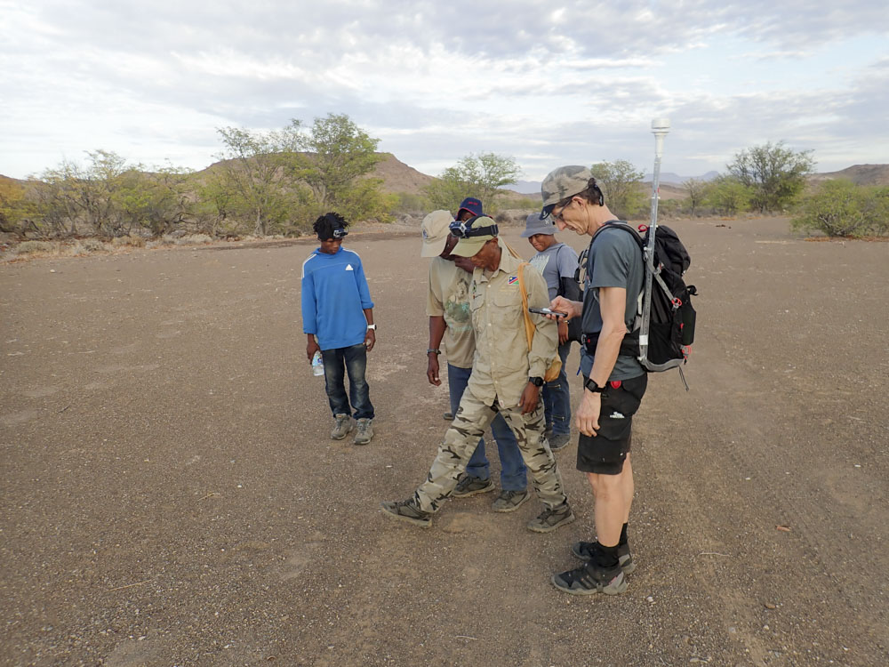
What occurred to be an issue during field work was the syncing of time across recording devices. As the collected data should be used for modelling, the position of participants had to be as exactly located in space (GPS) and time as possible. Internal time of the smartwatches, smartphones, camera and GoPro thus had to be in sync to less than one second. Each device either directly or indirectly (via smartphone app) were able to sync time via the GPS signal. But due to differences in the GPS signal quality between the devices and software limitations neither GPS guided time syncing, nor manual time setting was possible to the desired accuracy. The synchronization of the time thus became a time-consuming process, an issue that must be improved for the following field seasons, e.g. by setting up a local time server.
At the end of each day, data had to be downloaded from each of these devices in order to avoid data loss in case of software failure, hardware damage or loss. Since each device requires its own software and process for export, a powerful but lightweight laptop (Lenovo Thinkpad T480) was used to collect and store the files and to distribute it on two separate external hard drives (2x 2TB Western Digital Elements).
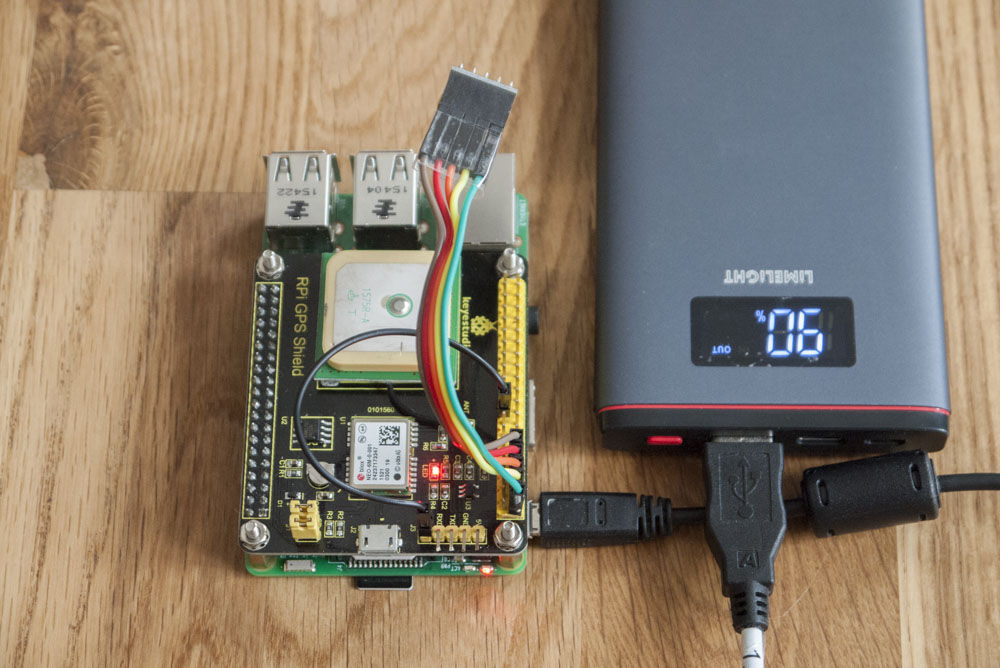
Power supply had to rely on solar energy, as sunlight is among the abundant resources in Namibia. Furthermore, solar panels are particularly small and neutral in noise and odour, in contrast to gasoline-powered generators. Using solar energy thus provided maintenance-free power supply and ensured that the wildlife was not disturbed. But electronic devices could not be connected directly to solar panels, as fluctuations in the output current leads to rapid deterioration of the internal batteries. Furthermore, devices could not be charged until after sunset, as they were used during the day. The use of up-to-date powerbanks solved both these problems, as they can handle fluctuations in the input power.
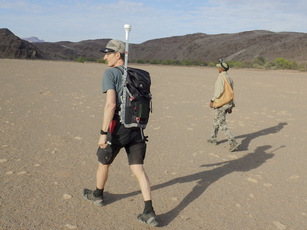
Wind measerement
During the first field research (→ Fieldwork dry season 2019) it turned out that one important factor had been unconsidered in the design of the hunting documentation: the wind. Due to the strongly contoured terrain, the wind conditions were very variable and dependent on the topographical conditions as well as the time of day. The decisions of the hunters regarding walking direction, the currently chosen hunting region and the techniques of approaching game depended strongly on wind direction and wind speed. The hunters themselves used simple methods to measure wind direction and wind speed at regular intervals (e.g. by regularly whirling up fine sand). But the wind-dependent decisions were not always openly communicated. Therefore, an independent measurement of wind conditions was necessary that allowed to interpret the decisions and the techniques used.
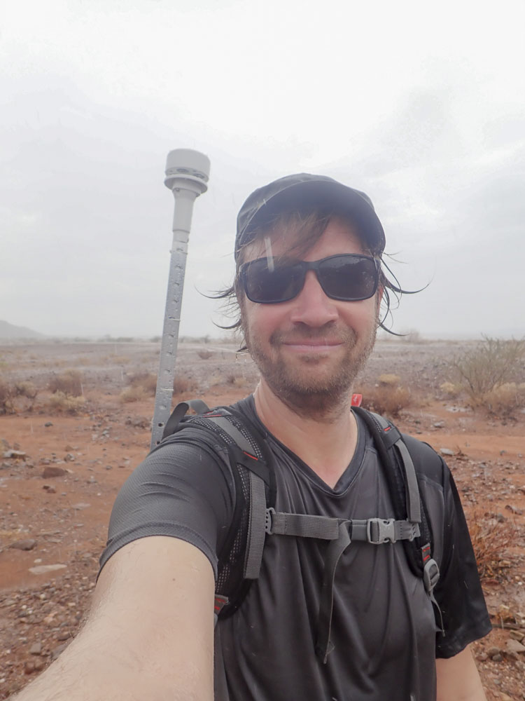
In order to be able to document the wind conditions during the daily hikes without intervening in the activities, a mobile wind measurement system was developed at short notice. The following parameters had to be considered:
The system had to
-
be able to measure wind strength and wind direction;
-
to run without moving parts such as wind vanes and cup anemometers, as their movement would have been strongly influenced by the walking movement thus producing nonsense data;
-
have an internal power source, since the walking movements could interrupt the contact to an external power source;
-
not be too heavy, so that it could be attached to the rucksack and required little physical effort when carried;
-
log data at minute or second intervals.
During the second field research campaign (→ Fieldwork wet season 2020), a system was used that meets these criteria, consisting of two ultrasonic wind anemometers from LCJ Capteur, coupled to battery-powered USB data loggers from Hobo.
Usually, the data output of a wind meter only makes sense only if the device is aligned to the north. However, a fixed positioning of the system was not possible due to the mobile use. Instead, the anemometers were attached to the backpack in such a way that they were aligned in the direction of travel. In this way, they did not produce absolute (north) wind direction values, but relative ones. These in turn could be converted using the GPS position and the direction of movement obtained from the coordinates.
Syncronisation of time between devices
The first task of the day is usually the synchronization of time between devices (Smartwatches, Smartphones, Go-Pro, Camera). Since this task depends heavily on the quality of the installed GPS antennas and a good GPS position, it took up to 40 minutes during the first field research campaign to reduce the deviation between the devices to less than 1 second.
What posed a problem during the fieldwork was the time synchronization between the recording devices. Since the collected data was to be used for modelling, the position of the participants had to be located as accurately as possible in space (GPS) and time. The internal time of the smart watches, smartphones, camera, GoPro and anemometers had to be synchronized to less than one second. Each device could either directly or indirectly (via a smartphone app) synchronize the time via the GPS signal. However, due to differences in GPS signal quality between the devices and software limitations, neither GPS controlled time synchronization nor manual time adjustment with the desired accuracy was possible. As a result, time synchronization became a time-consuming process every morning during the first field research (→ Fieldwork dry season 2019), which could take over half an hour and often did not produce the required result (time).
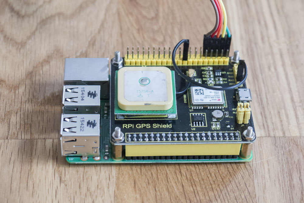

Individual time synchronisation of the devices via GPS led to fluctuations that often lasted several seconds and thus complicated an exact tracking of the temporal and spatial movements of the devices / persons. his problem could only be solved by using a timer or time server. However, since there is no mobile telephone reception in the study area, and thus no Internet-based time synchronization is possible, a time server had to be used that is
- GPS based. Since the time synchronization of the Smwartwatches is only possible directly via GPS reception or via paired smartphones, the time server
- must be able to distribute the time signal via WiFi. Thus, the time server had to act as a Wi-Fi router at the same time. Since electricity is only available from Powerbanks, the time server
- had to be operated with the 5 Volt USB connection of a Powerbank (see section Power supply).
All these requirements could be fulfilled cost-effectively with a Raspberry Pie 3. Thanks to an integrated Wi-Fi antenna and open-source, Linux-based operating systems (here Raspberry Pie OS), the minicomputer can be set up as a Wi-Fi router. An additional plug-in GPS module with integrated ceramic antenna accessed with the tool chrony, allowed to aquire the pulse per second (PPS) timer from the GPS signal. This way a NTP server could be set up in the local WiFi without Internet access. Thus, the reception and distribution of a GPS based time signal to the smartphones could be completely automated. However, the Raspberry Pie 3 does not have a real-time clock (RTC), which stores the system time until the next power-up, which makes the acquisition of a GPS fix and the PPS signal more time consuming.This problem was solved by using an additional plug-in battery powered real-time clock module.
Power supply
During field research power supply relies on solar energy. Sunlight is one of the abundant resources in Namibia, available everywhere. In addition, solar collectors are particularly small, noiseless and odourless, unlike petrol-driven generators. The use of solar energy thus provided a maintenance-free power supply and ensured that wildlife was not disturbed. However, electronic devices could not be connected directly to the solar panels, as fluctuations in the output current may lead to rapid deterioration of the internal batteries. In addition, the devices could only be charged after sunset as they were used during the day. The use of modern power banks solved both problems at once. They tolerate the fluctuating charging currents of the solar collectors and can deliver electricity while charging. Since field work was heavily dependent on electronic devices, the power supply was designed redundantly to cushion outages.
Next: Fieldwork dry season 2019
References
-
Herzog, I., 2013. The potential and limits of optimal path analysis, in: Bevan, A., Lake, M. (Eds.), Computational Approaches to Archaeological Spaces, UCL Institute of Archaeology Publications. Left Coast Press, Walnut Creek, California, pp. 179–211.
-
Seshadri, D.R., Li, R.T., Voos, J.E., Rowbottom, J.R., Alfes, C.M., Zorman, C.A., Drummond, C.K., 2019. Wearable sensors for monitoring the internal and external workload of the athlete. npj Digital Medicine 2, 71. DOI: 10.1038/s41746-019-0149-2
-
Phan, D., Siong, L.Y., Pathirana, P.N., Seneviratne, A., 2015. Smartwatch: Performance evaluation for long-term heart rate monitoring, in: 2015 International Symposium on Bioelectronics and Bioinformatics (ISBB). Institute of Electrical and Electronics Engineers Inc., Online publication, pp. 144–147. DOI: 10.1109/ISBB.2015.7344944
-
Spierer, D.K., Rosen, Z., Litman, L.L., Fujii, K., 2015. Validation of photoplethysmography as a method to detect heart rate during rest and exercise. Journal of Medical Engineering & Technology 39, 264–271. DOI: 10.3109/03091902.2015.1047536
-
Shcherbina, A., Mattsson, C.M., Waggott, D., Salisbury, H., Christle, J.W., Hastie, T., Wheeler, M.T., Ashley, E.A., 2017. Accuracy in Wrist-Worn, Sensor-Based Measurements of Heart Rate and Energy Expenditure in a Diverse Cohort. Journal of Personalized Medicine 7, 3. DOI: 10.3390/jpm7020003
-
Sartor, F., Gelissen, J., van Dinther, R., Roovers, D., Papini, G.B., Coppola, G., 2018. Wrist-worn optical and chest strap heart rate comparison in a heterogeneous sample of healthy individuals and in coronary artery disease patients. BMC sports science, medicine & rehabilitation 10, 10--10. DOI: 10.1186/s13102-018-0098-0
-
Terbizan, D.J., Dolezal, B.A., Albano, C., 2002. Validity of Seven Commercially Available Heart Rate Monitors. Measurement in Physical Education and Exercise Science 6, 243–247. DOI: 10.1207/S15327841MPEE0604\_3
-
Wulder, M.A., Coops, N.C., Roy, D.P., White, J.C., Hermosilla, T., 2018. Land cover 2.0. International Journal of Remote Sensing 39, 4254–4284. DOI: 10.1080/01431161.2018.1452075
- Zamparo, P., Perini, R., Orizio, C., Sacher, M., Ferretti, G., 1992. The energy cost of walking or running on sand. European Journal of Applied Physiology and Occupational Physiology 65, 183–187. DOI: 10.1007/BF00705078
-
Romanowska, I., 2015. Agent-based modelling and archaeological hypothesis testing: The case study of the European Lower Palaeolithic, in: Traviglia, A. (Ed.), Across Space and Time. Amsterdam University Press, Amsterdam, pp. 203--214.
-
Tanaka, J., 1976. Subsistence ecology of central Kalahari San, in: Lee, R.B., DeVore, I. (Eds.), Kalahari Hunter-Gatherers: Studies of the !Kung and Their Neighbours. Harvard University Press, Cambridge, pp. 98–119.
-
Liebenberg, L., Steventon, L., Benadie, K., Minye, J., 1999. Rhino tracking with the CyberTracker field computer. Pachyderm 27, 59–61.
-
Ansell, S., Koenig, J., 2011. CyberTracker: An integral management tool used by rangers in the Djelk Indigenous Protected Area, central Arnhem Land, Australia. Ecological Management & Restoration 12, 13–25. DOI: 10.1111/j.1442-8903.2011.00575.x